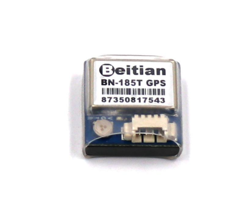
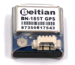
Beitian BN-185T GNSS Module + Antenna Datasheet Revision 5.39
Features
| Item | Description | |
| Electrical Characteristics | Chipset | M8030-KT |
| Frequency | GPS L1, GLONASS L1, BDS B1, GALILEO E1, SBAS L1, QZSS L1 | |
| Receiving Format | GPS, GLONASS, BDS, GALILEO, SBAS, QZSS.Default GPS, GLONASS, SBAS, QZSS. | |
| Channels | 72 Searching Channel | |
| Sensitivity | Tracking | -167dBm |
| Reacquisition | -160dBm | |
| Cold Start | -148dBm | |
| Hot Start | -156dBm | |
| Accuracy | Position Horizontal | 2.0 m CEP 2D RMS SBAS Enable (Typical Open Sky) |
| Velocity | 0.1m/sec 95% (SA off) | |
| Timing | 1us synchronized to GPS time | |
| Acquisition Time | Cold Start | 26s |
| Warm Start | 25s | |
| Hot Start | 1s | |
| Data Output | Support Rate | 4800bps to 921600bps, Default 9600bps |
| Data Level | TTL Level | |
| Data Protocol | NMEA-0183 | |
| NMEA message | RMC, VTG, GGA, GSA, GSV, GLL | |
| Concurrent GNSS | 1Hz-10Hz, Default 1Hz | |
| FLASH | 4M FLASH, Store the configuration permanently | |
| Operational Limits | Altitude | <50,000m |
| Velocity | <515m/s | |
| Acceleration | <4g | |
| Power Consumption | VCC | DC Voltage 3.6V-5.5V, Typical: 5.0V |
| Current | Capture 50mA/5.0V | |
| Mechanical Specifications | Dimension | 18.5mm*18.5mm*9.5mm |
| Weight | 8.1g | |
| Connector | 1.25mm 4pins connector | |
| Environment | Operating Temp | -40 °C ~ +85°C |
| Storage Temp | -40°C ~ +105°C | |
| LED | Built-in LED | TX LED: blue. The data output, TX LED flashing |
Pin Description

| PIN | PIN Name | I/O | Description |
| 1 | RX | I | TTL Serial Data Input. |
| 2 | TX | O | TTL Serial Data Output. |
| 3 | GND | G | Ground |
| 4 | VCC | I | DC 3.6V – 5.5V supply input, Typical: 5.0V |
LED
- TX LED: blue. The data output, TX LED flashing
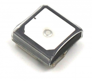
Bottom view
DIMENSION 
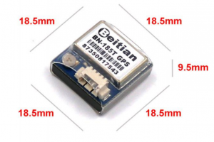 18.5mm*18.5mm*9.5mm
NMEA message output sample:$GNRMC,073114.00,A,2237.56240,N,11401.59614,E,1.329,21.11,020916,,,A, *37$GNVTG,21.11,T,,M,1.329,N,2.462,K,A*1B$GNGGA,073114.00,2237.56240,N,11401.59614,E,1,12,0.78,112.9,M,-2.5,M,, 54$GNGSA,A,3,19,05,02,06,17,12,09,13,,,,,1.48,0.78,1.26,1*01$GNGSA,A,3,69,83,84,70,68,82,,,,,,,1.48,0.78,1.26,2*0E$GPGSV,4,1,13,02,46,340,36,05,52,254,37,06,42,041,41,09,22,053,40,0*6E$GPGSV,4,2,13,12,32,282,35,13,13,185,33,17,36,131,37,19,57,119,44,0*66$GPGSV,4,3,13,20,03,237,,23,00,038,,25,09,311,19,42,51,128,32,0*60$GPGSV,4,4,13,50,46,123,33,0*50$GLGSV,2,1,08,68,25,027,39,69,78,011,36,70,40,213,43,74,00,259,,0*78$GLGSV,2,2,08,82,06,124,36,83,46,085,44,84,44,358,41,85,05,324,14,0*74$GNGLL,2237.56240,N,11401.59614,E,073114.00,A,A*7C
NMEA Message Talker IDs
| Configured GNS | Talker ID |
| GPS, SBAS, QZSS | GP |
| GLONASS | GL |
| GALILEO | GA |
| BEIDOU | GB |
| Any combination of GNSS | GN |
NMEA Message Structure
$xxGGA,time,lat,NS,long,EW,quality,numSV,HDOP,alt,M,sep,M,diffAge,diffS ation*csExample: $GPGGA,092725.00,4717.11399,N,00833.91590,E,1,08,1.01,499.6,M,48.0,M,, 5B
| Field No | Name | Unit | Format | Example | Description |
| 0 | xxGGA | – | string | $GPGGA | GGA Message ID (xx = current Talker ID) |
| 1 | time | – | hhmmss.ss | 092725.00 | UTC time |
| 2 | lat | – | ddmm.mmmmm | 4717.11399 | Latitude (degrees & minutes) |
| 3 | NS | – | character | N | North/South indicator |
| 4 | long | – | dddmm.mmmmm | 00833.91590 | Longitude (degrees & minutes) |
| 5 | EW | – | character | E | East/West indicator |
| 6 | quality | – | digit | 1 | 0: No Fix / Invalid 1:Standard GPS (2D/3D) 2:Differential GPS6: Estimated (DR) Fix |
| 7 | numSV | – | numeric | 08 | Number of satellites used |
| 8 | HDOP | – | numeric | 1.01 | Horizontal Dilution of Precision |
| 9 | alt | m | numeric | 499.6 | Altitude above mean sea level |
| 10 | uAlt | – | character | M | Altitude units: meters (fixed field) |
| 11 | sep | m | numeric | 48.0 | Geoid separation: difference between
geoid and mean sea level |
| 12 | uSep | – | character | M | Separation units: meters (fixed field) |
|
13 |
diffAge |
s |
numeric |
– |
Age of differential corrections (blank when DGPS is not used) |
|
14 |
diffStation |
– |
numeric |
– |
ID of station providing differential corrections (blank when DGPS is not used) |
| 15 | cs | – | hexadecimal | *5B | Checksum |
| 16 | <CR><LF> | – | character | – | Carriage return and line feed |
Message Structure:$xxGLL,lat,NS,long,EW,time,status,posMode*csExample:$GPGLL,4717.11364,N,00833.91565,E,092321.00,A,A*6
| Field No | Name | Unit | Format | Example | Description |
| 0 | xxGLL | – | string | $GPGLL | GLL Message ID (xx = current Talker ID) |
| 1 | lat | – | ddmm.mmmmm | 4717.11364 | Latitude (degrees & minutes) |
| 2 | NS | – | character | N | North/South indicator |
| 3 | long | – | dddmm.mmmmm | 00833.91565 | Longitude (degrees & minutes) |
| 4 | EW | – | character | E | East/West indicator |
| 5 | time | – | hhmmss.ss | 092321.00 | UTC time |
| 6 | status | – | character | A | V = Data invalid or receiver warning, A = Data valid |
| 7 | posMode | – | character | A | Positioning mode |
| 8 | cs | – | hexadecimal | *60 | Checksum |
| 9 | <CR><LF> | – | character | – | Carriage return and line feed |
Message Structure: $xxGSA,opMode,navMode{,sv},PDOP,HDOP,VDOP,systemId*csExample:$GPGSA,A,3,23,29,07,08,09,18,26,28,,,,,1.94,1.18,1.54,1*0D
| Field No | Name | Unit | Format | Example | Description |
| 0 | xxGSA | – | string | $GPGSA | GSA Message ID (xx = current Talker ID) |
| 1 | opMode | – | character | A | Operation modeM:Manually set to operate in 2D or 3D modeA:Automatically switching between 2D or 3D mode |
| 2 | navMode | – | digit | 3 | Navigation mode 1:Fix not available 2:2D Fix 3:3D Fix |
| Start of repeated block (12 times) | |||||
| 3 + 1*N | sv | – | numeric | 29 | Satellite number |
| End of repeated block | |||||
| 15 | PDOP | – | numeric | 1.94 | Position dilution of precision |
| 16 | HDOP | – | numeric | 1.18 | Horizontal dilution of precision |
| 17 | VDOP | – | numeric | 1.54 | Vertical dilution of precision |
| 18 | systemId | – | numeric | 1 | NMEA defined GNSS System ID NMEA v4.1 and above only |
| 19 | cs | – | hexadecimal | *0D | Checksum |
| 20 | <CR><LF> | – | character | – | Carriage return and line feed |
Message Structure:$xxGSV,numMsg,msgNum,numSV,{,sv,elv,az,cno},signalId*csExample: $GPGSV,3,1,10,23,38,230,44,29,71,156,47,07,29,116,41,08,09,081,36,0*7F $GPGSV,3,2,10,10,07,189,,05,05,220,,09,34,274,42,18,25,309,44,0*72 $GPGSV,3,3,10,26,82,187,47,28,43,056,46,0*7
| Field No | Name | Unit | Format | Example | Description |
| 0 | xxGSV | – | string | $GPGSV | GSV Message ID (xx = GSV Talker ID) |
| 1 | numMsg | – | digit | 3 | Number of messages, total number of GSV messages being output |
| 2 | msgNum | – | digit | 1 | Number of this message |
| 3 | numSV | – | numeric | 10 | Number of satellites in view |
| Start of repeated block (1..4 times) | |||||
| 4 +
4*N |
SV |
– |
numeric |
23 |
Satellite ID |
| 5 +
4*N |
elv | deg | numeric | 38 | Elevation (range 0-90) |
| 6 +
4*N |
az | deg | numeric | 230 | Azimuth, (range 0-359) |
| 7 +
4*N |
cno | dBH | numeric | 44 | Signal strength (C/N0, range 0-99), blank when not tracking |
| End of repeated block | |||||
| 5..
16 |
signalId |
– |
numeric |
0 |
NMEA defined GNSS Signal ID (0 = All signals) NMEA v4.1 and above only |
| 6..
16 |
cs | – | hexadecimal | *7F | Checksum |
| 7..
16 |
<CR><LF> | – | character | – | Carriage return and line feed |
Message Structure: $xxRMC,time,status,lat,NS,long,EW,spd,cog,date,mv,mvEW,posMode,navStat s*cs Example: $GPRMC,083559.00,A,4717.11437,N,00833.91522,E,0.004,77.52,091202,,,A,V*57
| Field No | Name | Unit | Format | Example | Description |
| 0 | xxRMC | – | string | $GPRMC | RMC Message ID (xx = current Talker ID) |
| 1 | time | – | hhmmss.ss | 083559.00 | UTC time, see note on UTC representation |
| 2 | status | – | character | A | StatusV:Navigation receiver warningA :Data valid, see position fix flags description |
| 3 | lat | – | ddmm.mmmmm | 4717.11437 | Latitude (degrees & minutes), see format description |
| 4 | NS | – | character | N | North/South indicator |
| 5 | long | – | dddmm.mmmmm | 00833.91522 | Longitude (degrees & minutes), see
format description |
| 6 | EW | – | character | E | East/West indicator |
| 7 | spd | Knos | numeric | 0.004 | Speed over ground |
| 8 | cog | degr | numeric | 77.52 | Course over ground |
| 9 | date | – | ddmmyy | 091202 | Date in day, month, year format, see note on UTC representation |
| 10 | mv | degrees | numeric | – | Magnetic variation value (blank – not supported) |
| 11 | mvEW | – | character | – | Magnetic variation E/W indicator (blank – not supported) |
| 12 | posMode | – | character | – | Mode Indicator, see position fix flags |
| 13 | navStatus | – | character | V | Navigational status indicator (V = Equipment is not providing navigational status information) |
| 14 | cs | – | hexadecimal | *57 | Checksum |
| 15 | <CR><LF> | – | character | – | Carriage returns and line feed |
Message Structure:$xxVTG,cogt,T,cogm,M,knots,N,kph,K,posMode*csExample:$GPVTG,77.52,T,,M,0.004,N,0.008,K,A*06
| Field No | Name | Unit | Format | Example | Description |
| 0 | xxVTG | – | string | $GPVTG | VTG Message ID (xx = current Talker ID) |
| 1 | cogt | degrees | numeric | 77.52 | Course over ground (true) |
| 2 | T | – | character | T | Fixed field: true |
| 3 | cogm | degrees | numeric | – | Course over ground (magnetic), not output |
| 4 | M | – | character | M | Fixed field: magnetic |
| 5 | knots | knots | numeric | 0.004 | Speed over ground |
| 6 | N | – | character | N | Fixed field: knots |
| 7 | kph | km/ | numeric | 0.008 | Speed over ground |
| 8 | K | – | character | K | Fixed field: kilometers per hour |
| 9 | posMode | – | character | A | Mode Indicator, see position fix flags
description |
| 10 | cs | – | hexadecimal | *06 | Checksum |
| 11 | <CR><LF> | – | character | – | Carriage return and line feed |
Beitian BN-185T GNSS Module Antenna Datasheet Revision 5.39 User Manual – Beitian BN-185T GNSS Module Antenna Datasheet Revision 5.39 User Manual –
[xyz-ips snippet=”download-snippet”]